


A violent F-4 tornado destroyed most of Spencer, SD on 30 May 1998. According to DOW data, hurricane force winds (> about 35 m/s) first hit the town at approximately 8:38pm CDT. The center of the tornado was over Spencer at 8:39pm (W edge of town at 8:38:30, E edge of town at 8:39:30), winds of 106-110 m/s (237-246 mph) occured to the south of the tornado at that time. Winds dropped below hurricane force by 8:40pm. The storm was moving at approximately 15 m/s (32 mph) to the ESE. Winds would have increased from hurricane force (35 m/s) to devastating force (~100 m/s or 200 mph) in about 20 seconds. The track of the tornado, appears below.
A roughly 200 m swath of F3/F4 damage (unofficial) was observed in Spencer by DOW crews. The NWS has categorized the damage as up to F4. The worst observed damage was S of the DOW center track, as expected.
Only DOW3 was functional so only single-Doppler data is available.
Peak tornado relative winds were approximately 85 m/s (190 mph)
DOW3 took data in the forming tornado from S of Fulton SD starting at approximately 8:03 (1:03 UTC) until ~8:22 (1:22 UTC) with a 6-7 minute gap. DOW3 redeployed to 2.0 miles (3.5 km) WSW of Spencer by 8:33. The tornado center was 1.1 miles (1.7 km) to the NW of the DOW permitting extremely high resolution high prf observations as it moved towards Spencer, hitting the town at 8:37 (1:37 UTC).
Data is still being translated and analyzed, but early indications show Doppler velocities of 100 m/s, indicating ground relative winds of about 110 m/s (246 mph) to the S of the tornado. (This is based on a difference of 38 degrees between the observed track and the radial velocity direction and a 16 m/s velocity. Only obvious dealiasing has been performed on folds at 32 m/s and 96 m/s. Sub-tornado high shear/rotation zones have not been dealiased and might hold much higher velocities.)
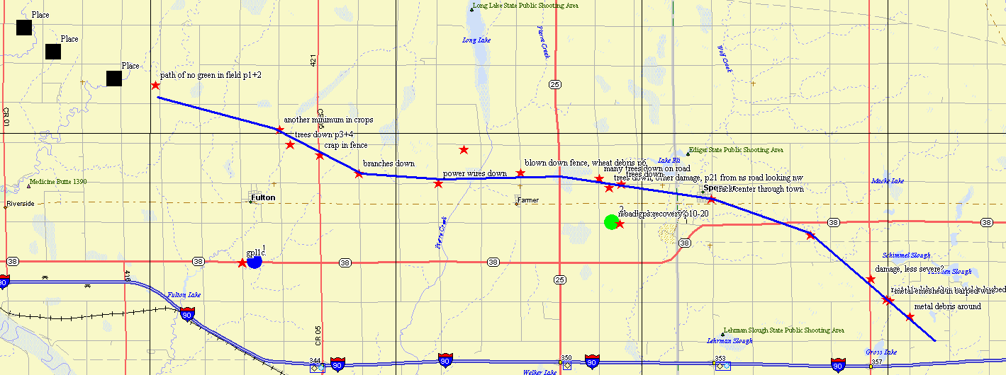
Black squares are pre-damage track tornado locations from DOW at 010336, 010603, and 010842
Stars are mostly ground-based sectional damage survey comments
The blue and green circles are approximate DOW deployment locations
The blue line is an approximate damage track, probably biased ~200 s of tornado center due to worse damage on the s side of the tornado.
Time of tornado in Spencer approximately 837-839 pm CDT or 0137-0139 UTC
The NWS has conducted a much better damage survey.
Radar Images (just a few)

Above: Pre-tornado: Curled hook echo and delta-V of 32 m/s, 4km w of earliest damage that we noticed from ground survey

Above: Tornado forming, dust visible on ground

Above: delta-V 47 m/s

Above: delta-V > 50 m/s
In the following sequence of images, the tornado is moving roughly E (left to right). Spencer is to E of high reflectivity disk at (0.8-1.5,3.8-4.5). Note strong shear zone to W of tornado. 75 m/s (Doppler) = 83 m/s (ground) zone is ~250 m which corresponds to region of total destruction in town. Reflectivity values are uncalibrated and saturated.

Above: Near closest approach to center (1.7 km), damage path to S of center approached within 1.3 km

Above: Tornado approaching the town of Spencer, SD

Above: Tornado about to hit Spencer. Grids 500 m, N is up, body of supercell is off top of page. Shear couplet is +98/-64.
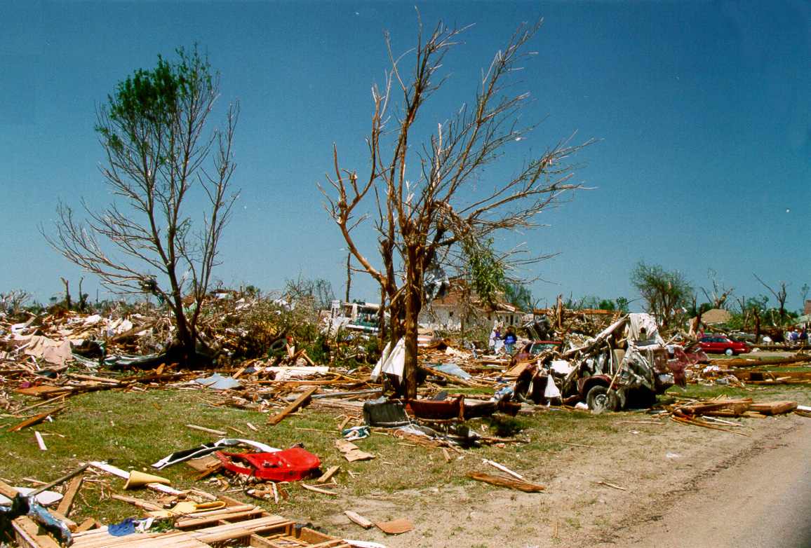
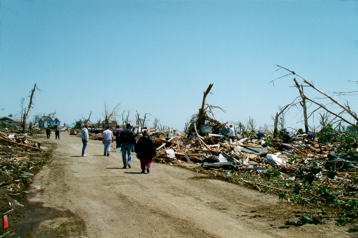
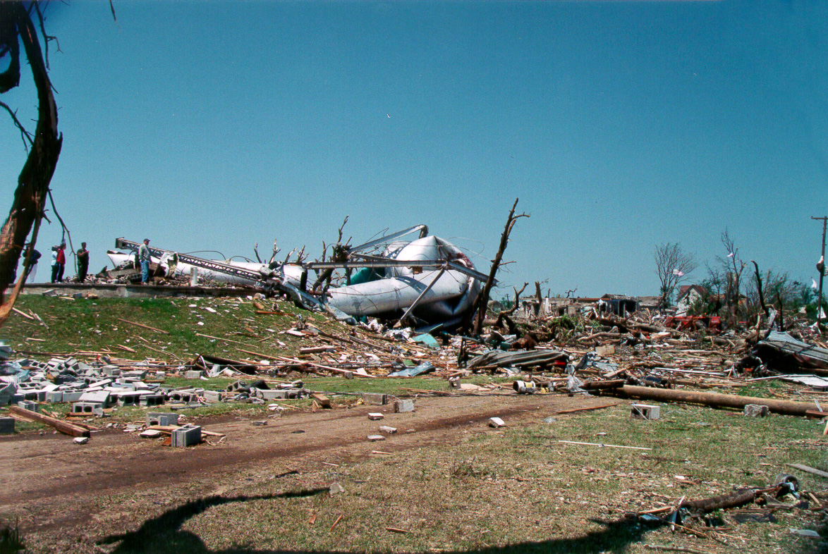
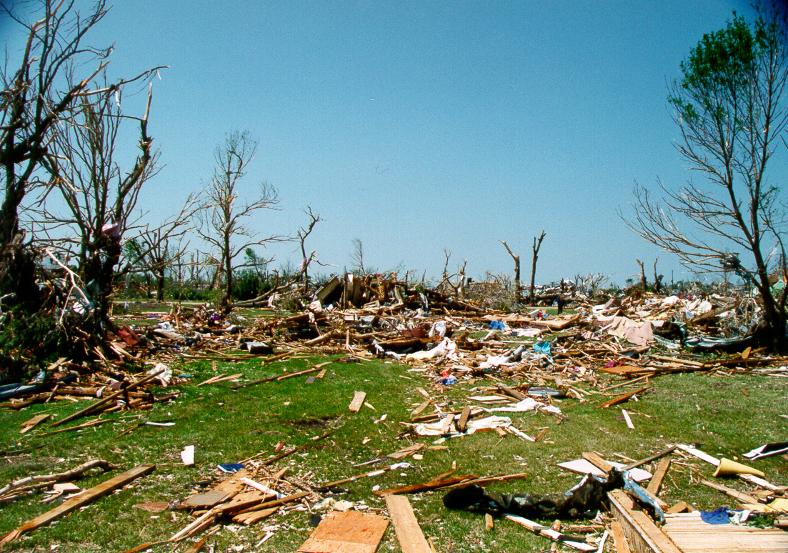
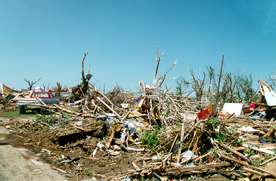
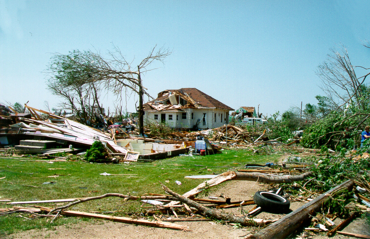
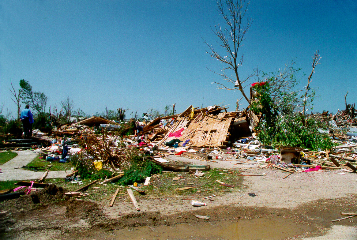
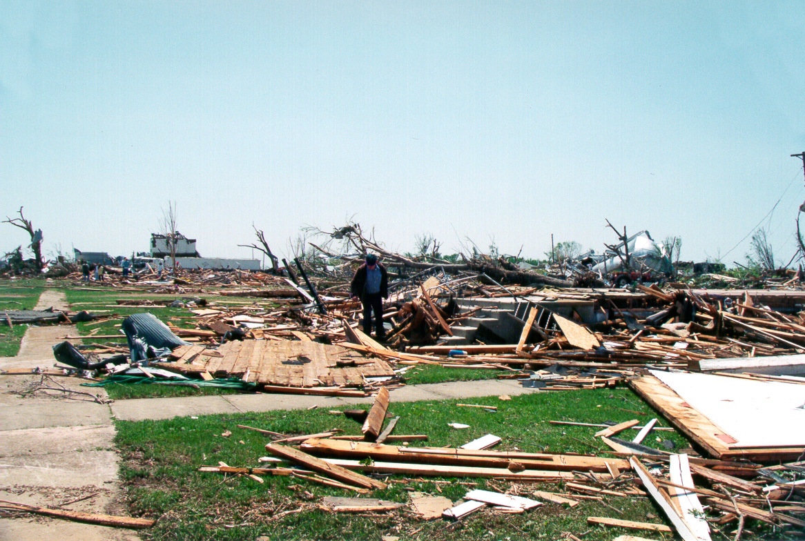
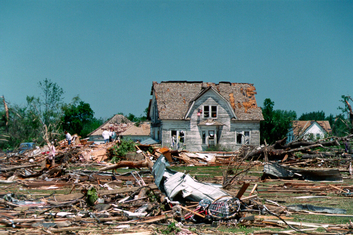
The following are images depicting damage which occurred within the town of Spencer, SD:

This page is still under construction. Please check back soon for more updates and information

 Go back