VORTEX-SE
Towards a better understanding of tornadogenesis and tornado environments in the Southeastern U.S.
Case Evaluation - IOP4c: 30 April, 2017
Evaluating dual-Doppler, dual-pol, surface, and upper air data collected during a weakening QLCS with small/weak bowing segments over Sand Mountain.
Mobile Radars: NOAA NOXP (X-band), OU SMART-R (C-band), UAH MAX (X-band); Stationary Radars: ARMOR (C-band), KTHX 88D (S-band). Other Observations: Soundings, TTU Stesonet, Disdrometers.
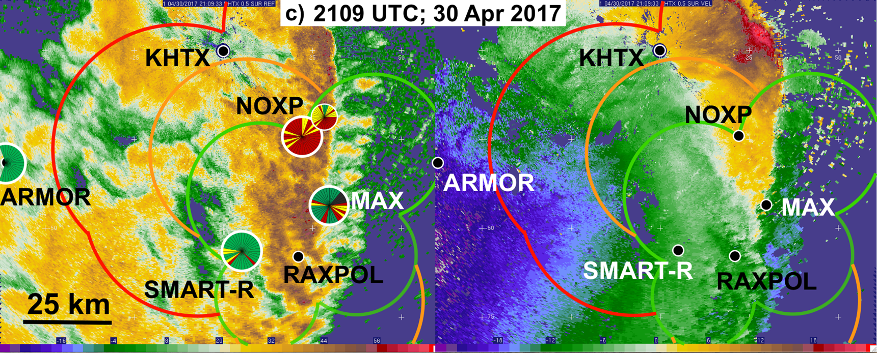
Best possible dual-Doppler coverage between VSE radars (not accounting for blockage, attenuation, etc.), with baselines: < 25 km (green), 25-40km (yellow), and > 40km (red). Circles overlaid on radar locations indicate qualitative assessment of unblocked (green), partly-blocked (yellow), and heavily-blocked (red) data sectors at the lowest available elevation angles (0.5° or 0.8°).