VORTEX-SE
Towards a better understanding of tornadogenesis and tornado environments in the Southeastern U.S.
Low-level Multi-Doppler Wind Technique Development
* Modified dual-Doppler code is available. Please contact kakosiba@cswr.org for more information.
Prior to VSE 2017 field phase: Algorithm development using dual-Doppler data collected with Doppler on Wheels (DOW) radars and dense network of in situ surface instruments during VORTEX-2, including terrain in the lower BC.
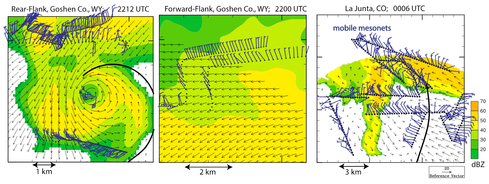
Illustration of the dual-Doppler radar and in situ data used for the initial modification of wind retrieval software. Near-surface dual-Doppler-retrieved horizontal winds (vectors) and radar reflectivity (shaded) for three analyses of two supercells observed with DOW radars during VORTEX2; left: the rear flank of the Goshen CO., WY, storm, middle: a portion of the Goshen storm’s forward flank, and, right: the La Junta, CO, storm. Locations of near-surface gust fronts are traced (black lines) and positions of near-surface in situ wind observations are shown in blue (time-space converted, valid within 3 min of the dual-Doppler analysis time).
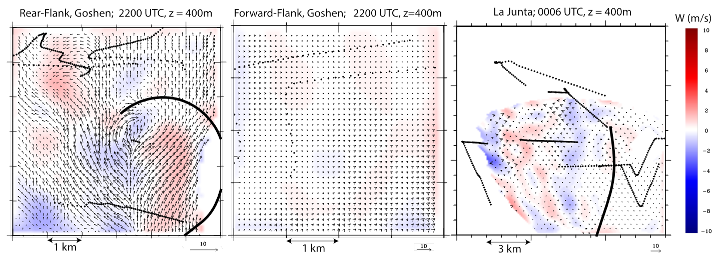
Difference between dual-Doppler horizontal (vectors) and vertical (shaded) velocity retrievals when solutions include and exclude objectively analyzed surface wind observations. For reference, thick black lines indicate positions of near-surface gust fronts and black dots indicate positions of raw surface observations used in each retrieval.
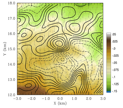
Vertical velocity at z = 0 m with the inclusion of terrain in the dual-Doppler retrievals in the Goshen Co., WY, case. Color contours indicate terrain height in km relative to the altitude of the lowest radar; solid (dashed) lines are upward (downward) vertical velocities in m/s; vectors depict the horizontal winds.
IOP 4C, 30 APRIL 2017: Weakening QLCS with small/weak bowing segments over Sand Mountain.
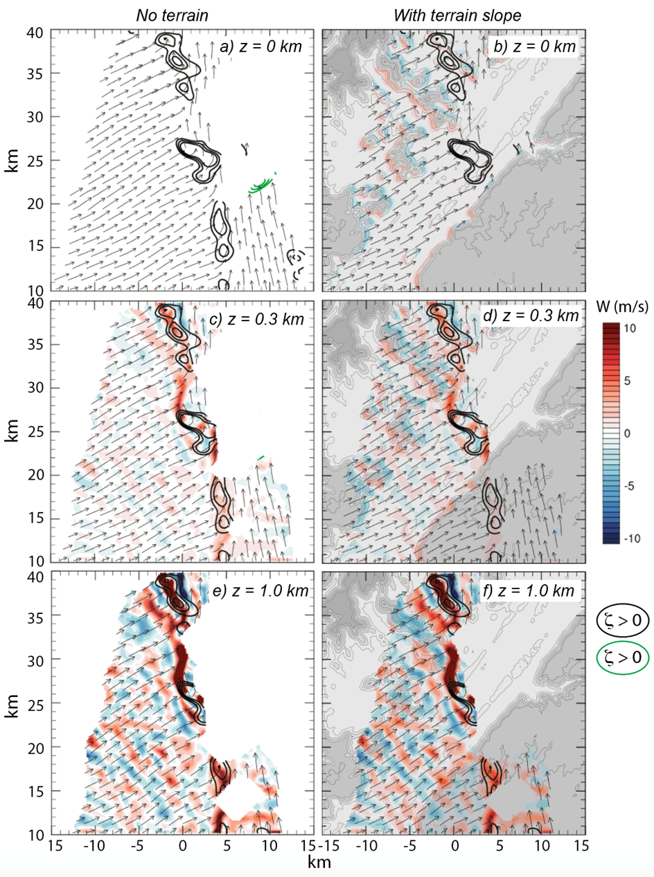
Dual-Doppler wind syntheses (horizontal winds are vectors, vertical velocity is shaded) at various levels above the bottom of the grid (at z = 0, 300, 1000m) that assume: flat ground at z = 0 km (left) and sloped terrain (right). Fields are overlaid on top of USGS topography (gray shaded).
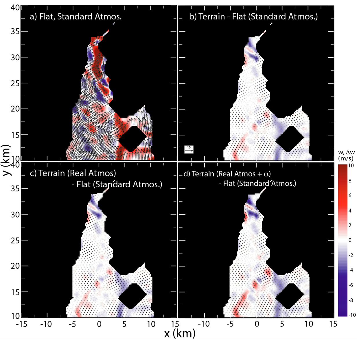
Comparison of dual-Doppler wind syntheses from four experiments, two assuming standard atmospheric conditions with i) flat ground or ii) realistic terrain (with α=1 everywhere; i.e., our Froude number effect is disengaged), and two with terrain that also include iii) realistic sounding-measured ρ(z), and iv) the Froude number term described above. Vertical acceleration by terrain slope itself (W_terr ≠0) in a standard atmosphere produced the largest overall difference from the flat ground and standard atmosphere experiments (a-b). Using a realistic ρ(z) in (1), measured from a sounding collected behind the gust front produced virtually no difference in dual-Doppler vertical velocity (c). Further modification of the surface vertical velocity by the α=1−z(k_terr)/h_max term increased the perturbation in vertical velocity located along terrain gradients by up to ~ 0.5 m/s (d), but these perturbations are typically weaker than those forced by the terrain itself.
Next → Downdraft Kinematics